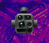
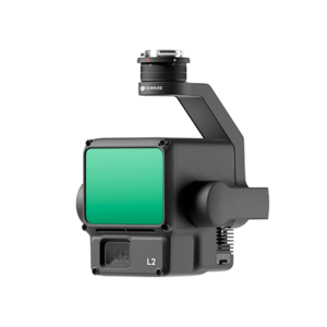
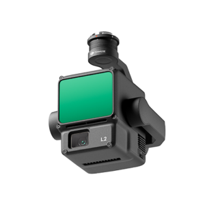
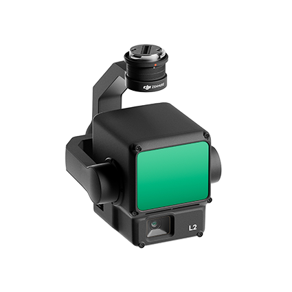
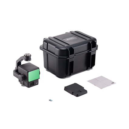
PROMOTIONS AND OFFERS
Discounts on multiple DJI, EMLID and Pix4D products

We offer all kinds of technical solutions for companies and individuals. We advise you and inform you of everything.

Secure payment Secure payment
Shipping in 24/48 h. Shipping in 24/48h
Technical advice Technical advice

Zenmuse L2

From: 10.800,00

DJI Zenmuse L2 – Aerial Lidar for Drone

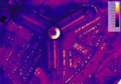
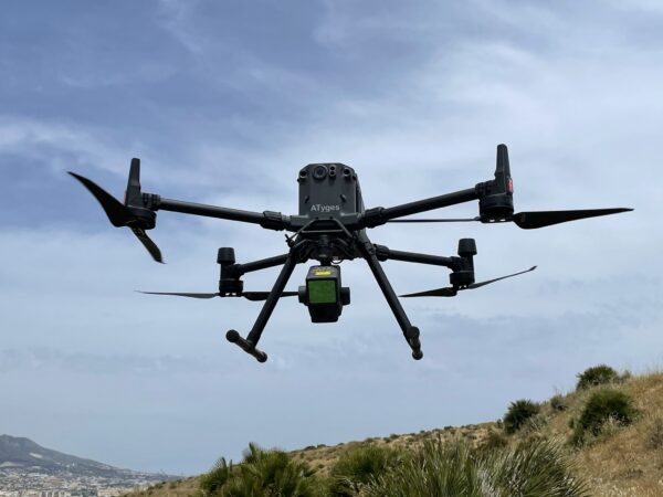
Zenmuse L2 integrates frame LiDAR, a self-developed high-precision IMU system, and an RGB mapping camera with 4/3 CMOS to enable DJI Matrice 350 RTK and Matrice 300 RTK flight platforms to obtain more accurate geospatial data, efficient and reliable.

When used with DJI Terra, it offers an all-in-one, out-of-the-box solution for 3D data collection and high-precision post-processing. It can be used in surveying, engineering, construction, agriculture, security, for land inspection and mapping, and electric power, forestry, and infrastructure management.

Main features

  • High accuracy
    • Vertical accuracy: 4 cm.
    • Horizontal precision: 5 cm.
  • Exceptional efficiency
    • 2.5 km2 covered in a single flight.
  • Superior penetration
    • Smaller laser points, denser point clouds.
  • Detection range
    • 250 m with 10% reflectivity and 100 lx
    • 450 m at 50% reflectivity and 0 lx
  • 5 returns.
  • All in one, ready to use.
  • Live view of the point cloud.
  • Processing in DJI Terra with just one click.

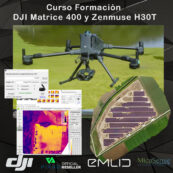
Take advantage and acquire, along with your sensor, the personalized training course on the use of this tool taught by our engineers: DJI Lidar Training Course

We improve your budget: Do not hesitate to contact us!

Check availability and request a quote using this form and we will send you a personalized offer

You may also like…

Jess Gregory
Jess Gregory
2022-08-22
Excellent software for processing drone images, excellent communication, nice people! Thank you so much. Highly recommend their software!
Razib Ahmed
Razib Ahmed
2022-08-22
Great team with experienced professionals. I experienced quick response from the technical support team eventhough I was not their customer. Thank you Fede A and your team.
Esteban Laffitte
Esteban Laffitte
2021-12-19
Gran equipo de profesionales, siempre dispuestos a aclarar cualquier duda tanto en la pre como en la post-venta. Enhorabuena por el servicio qué ofreceis y la calidad de los productos que vendeis.
JOSÉ ANTONIO MARTÍNEZ SÁNCHEZ
2021-12-17
He colaborado con ellos, son muy profesionales y muy recomendables.
Jose Maria Marin Poley
2021-09-23
Hasta ahora todo correcto y rápido.
Maxi Diaz
Maxi Diaz
2021-09-15
La atención al cliente ha sido excelente. Envío a Canarias sin complicación. Recomendado.

Integrated LiDAR Solution

Supported by its powerful hardware, L2 can allow for a precise scan of complex subjects within an extended range and faster point cloud acquisition. During operations, users can preview, playback, and process point cloud models on-site, with Task Quality Reports generated by DJI Terra, offering a simple, one-stop solution to improve overall efficiency. This enables users to achieve high-precision point cloud results with one-stop post-processing.

30% Detection Range Increase [5]

L2 can detect from 250 meters at 10% reflectivity and 100 klx, [3] and up to 450 meters at 50% reflectivity and 0 klx. [3] The typical operational altitude now extends up to 120 meters, notably enhancing operational safety and efficiency.

Smaller Laser Spots, Denser Point Clouds

With a reduced spot size of 4×12 cm @100m, only a fifth of that of L1, L2 not only detects smaller objects with more details, but can also penetrate denser vegetation, generating more accurate digital elevation models (DEM).

Supports 5 Returns

In densely vegetated areas, L2 can capture more ground points beneath the foliage.

Effective Point Cloud Rate: 240,000 pts/s

In both single and multiple return modes, L2 can reach a max point cloud emission rate of 240,000 points per second, allowing the acquisition of more point cloud data in a given time frame.

Two Scanning Modes

L2 supports two scanning modes, offering flexibility for users based on their task demands. In repetitive scanning mode, L2’s LiDAR can achieve more uniform and accurate point clouds while meeting high-precision mapping requirements. In non-repetitive scanning mode, it offers deeper penetration for more structural information, making it suitable for power line inspection, forestry surveying, and other scenarios.

Frame-based Design

The frame-based design results in an effective point cloud data rate of up to 100%. Together with a three-axis gimbal, it brings more possibilities to surveying scenarios.

High-Accuracy IMU System

Improved Accuracy

The high-accuracy self-developed IMU system, combined with the drone’s RTK positioning system for data fusion during post-processing, gives L2 access to highly accurate absolute position, speed, and attitude information. In addition, the IMU system’s enhanced environmental adaptability improves the operational reliability and precision of L2.

  • Yaw Accuracy [6]
    • Real-time: 0.2°, post-processing: 0.05°
  • Pitch/Roll Accuracy [6]
    • Real-time 0.05°, post-processing 0.025°

No IMU Warm-up

The performance of the IMU system has been significantly enhanced, and it is ready for use the moment it’s powered on. And, the accompanying drone is ready to begin tasks immediately once the RTK is in FIX status, delivering an optimized in-the-field experience.

RGB Mapping Camera

4/3 CMOS, Mechanical Shutter

Pixel size has been enlarged to 3.3 μm, and effective pixels now reach 20 MP, resulting in a significant improvement in overall imaging, as well as more enriched true-color point cloud details. The minimum photo interval has been reduced to 0.7 seconds. The mapping camera has a shutter count of up to 200,000 times, further reducing operational costs. When point cloud collection is not needed, the RGB camera can still take photos and videos, or collect images for visible light mapping.

Enhanced Operational Experience

Notes:

  1. Measured under the following conditions in a DJI laboratory environment: Zenmuse L2 mounted on a Matrice 350 RTK and powered on. Using DJI Pilot 2’s Area Route to plan the flight route (with Calibrate IMU enabled). Using repetitive scanning with the RTK in FIX status. The relative altitude was set to 150 m, flight speed to 15 m/s, gimbal pitch to -90°, and each straight segment of the flight route was less than 1500 m. The field contained objects with obvious angular features, and used exposed hard ground checkpoints that conformed to the diffuse reflection model. DJI Terra was used for post-processing with Optimize Point Cloud Accuracy enabled. Under the same conditions with Optimize Point Cloud Accuracy not enabled, the vertical accuracy is 4 cm and the horizontal accuracy is 8 cm.

  2. Measured with Zenmuse L2 mounted on Matrice 350 RTK with a flight speed of 15 m/s, flight altitude of 150 m, side overlap rate of 20%, Calibrate IMU enabled, Elevation Optimization turned off, and terrain follow turned off.

  3. The data presented are typical values. Measured using a flat subject with a size larger than the laser beam diameter, a perpendicular angle of incidence, and an atmospheric visibility of 23 km. In low-light environments, the laser beams can achieve the optimal detection range. If a laser beam hits more than one subject, the total laser transmitter power is split and the achievable range is reduced. The maximum detection range is 500 m.

  4. After power is turned on, the IMU doesn’t require warm-up; however, users must wait for the drone RTK to be in the FIX status before it can fly and work.

  5. Calculated by comparing with Zenmuse L1.

  6. Measured under the following conditions in a DJI laboratory environment: Zenmuse L2 mounted on a Matrice 350 RTK and powered up. Using DJI Pilot 2’s Area Route to plan the flight route (with Calibrate IMU enabled). RTK in the FIX status. The relative altitude was set to 150 m, flight speed to 15 m/s, gimbal pitch to -90°, and each straight segment of the flight route was less than 1500 m.

  7. 3D models are processed by sparse representation.

  8. Only supports the generation of Waypoint, Area, and Linear Task Quality Reports.

Valóranos

Specs

General

  • Product Name

    • Zenmuse L2
  • Dimensions

    • 155×128×176 mm (L×W×H)
  • Weight

    • 905±5 g
  • Power

    • 28 W (typical)
      58 W (max.)
  • IP Rating

    • IP54
  • Supported Aircraft

    • Matrice 300 RTK (requires DJI RC Plus)
      Matrice 350 RTK
  • Storage Temperature

    • -20° to 60° C (-4° to 140° F)

System Performance

  • Detection Range

    • 450m @50% reflectivity, 0 klx
      250m @10% reflectivity, 100 klxTypical data. Measured using a flat subject with a size larger than the laser beam diameter, perpendicular angle of incidence, and an atmospheric visibility of 23 km. In low-light environments, the laser beams can achieve the optimal detection range. If a laser beam hits more than one subject, the total laser transmitter power is split, and the achievable range is reduced. The maximum detection range is 500 m.

  • Point Cloud Rate

    • Single return: max. 240,000 pts/s
      Multiple returns: max. 1,200,000 pts/s
  • System Accuracy

    • Horizontal: 5 cm @ 150 m
      Vertical: 4 cm @ 150 mMeasured under the following conditions in a DJI laboratory environment: Zenmuse L2 mounted on a Matrice 350 RTK and powered up. Using DJI Pilot 2’s Area Route to plan the flight route (with Calibrate IMU enabled). Using repetitive scanning with the RTK in the FIX status. The relative altitude was set to 150 m, flight speed to 15 m/s, gimbal pitch to -90°, and each straight segment of the flight route was less than 1500 m. The field contained objects with obvious angular features, and used exposed hard ground check points that conformed to the diffuse reflection model. DJI Terra was used for post-processing with Optimize Point Cloud Accuracy enabled. Under the same conditions with Optimize Point Cloud Accuracy not enabled, the vertical accuracy is 4 cm and the horizontal accuracy is 8 cm.

  • Real-Time Point Cloud Coloring Coding

    • Reflectivity, Height, Distance, RGB

LiDAR

  • Ranging Accuracy (RMS 1σ)

    • 2 cm @ 150 m

      Measured in an environment of 25° C (77° F) with a subject of 80% reflectivity at a distance of 150 m. The actual environment may differ from the testing environment. The figure listed is for reference only.

  • Maximum Returns Supported

    • 5
  • Scanning Modes

    • Non-repetitive scanning pattern, Repetitive scanning pattern
  • FOV

    • Repetitive scanning pattern: Horizontal 70°, Vertical 3°
      Non-repetitive scanning pattern: Horizontal 70°, Vertical 75°
  • Minimum Detection Range

    • 3 m
  • Laser Beam Divergence

    • Horizontal 0.2 mrad, Vertical 0.6 mrad

      Measured at full width at half maximum (FWHM) conditions. 0.6 mrad signifies that for every 100m increase in distance, the diameter of the laser beam expands by 6 cm.

  • Laser Wavelength

    • 905 nm
  • Laser Spot Size

    • Horizontal 4 cm, vertical 12 cm @ 100 m (FWHM)
  • Laser Pulse Emission Frequency

    • 240 kHz
  • Laser Safety

    • Class 1 (IEC 60825-1:2014)
  • Accessible Emission Limit (AEL)

    • 233.59 nJ
  • Reference Aperture

    • Effective Aperture: 23.85 mm (equivalent to circular)
  • Max Laser Pulse Emission Power Within 5 Nanoseconds

    • 46.718 W

Inertial Navigation System

  • IMU Update Frequency

    • 200 Hz
  • Accelerometer Range

    • ±6 g
  • Angular Velocity Meter Range

    • ±300 dps
  • Yaw Accuracy (RMS 1σ)

    • Real-time: 0.2°, Post-processing: 0.05°

      Measured under the following conditions in a DJI laboratory environment: Zenmuse L2 mounted on a Matrice 350 RTK and powered up. Using DJI Pilot 2’s Area Route to plan the flight route (with Calibrate IMU enabled). RTK in the FIX status. The relative altitude was set to 150 m, flight speed to 15 m/s, gimbal pitch to -90°, and each straight segment of the flight route was less than 1500 m.

  • Pitch/Roll Accuracy (RMS 1σ)

    • Real-time: 0.05°, Post-processing: 0.025°

      Measured under the following conditions in a DJI laboratory environment: Zenmuse L2 mounted on a Matrice 350 RTK and powered up. Using DJI Pilot 2’s Area Route to plan the flight route (with Calibrate IMU enabled). RTK in the FIX status. The relative altitude was set to 150 m, flight speed to 15 m/s, gimbal pitch to -90°, and each straight segment of the flight route was less than 1500 m.

  • Horizontal Positioning Accuracy

    • RTK FIX: 1 cm + 1 ppm
  • Vertical Positioning Accuracy

    • RTK FIX: 1.5 cm + 1 ppm

RGB Mapping Camera

  • Sensor

    • 4/3 CMOS, Effective Pixels: 20 MP
  • Lens

    • FOV: 84°
      Format Equivalent: 24 mm
      Aperture: f/2.8-f/11
      Focus Points: 1 m to ∞ (with autofocus)
  • Shutter Speed

    • Mechanical Shutter: 2-1/2000 s
      Electronic Shutter: 2-1/8000 s
  • Shutter Count

    • 200000
  • Photo Size

    • 5280×3956 (4:3)
  • Still Photography Modes

    • Single shot: 20 MP
      Timed: 20 MP
      JPEG Timed Interval: 0.7/1/2/3/5/7/10/15/20/30/60 s
      RAW/JPEG + RAW Timed Interval: 2/3/5/7/10/15/20/30/60 s
  • Video Codec and Resolution

    • H.264
      4K: 3840×2160@30fps
      FHD: 1920×1080 @30fps
  • ISO

    • Video: 100-6400
      Photo: 100-6400
  • Video Bitrate

    • 4K: 85Mbps
      FHD: 30 Mbps
  • Supported File System

    • exFAT
  • Photo Format

    • JPEG/DNG (RAW)
  • Video Format

    • MP4 (MPEG-4 AVC/H.264)

Gimbal

  • Stabilization System

    • 3-axis (tilt, roll, pan)
  • Angular Vibration Range

    • 0.01°
  • Mounting

    • Detachable DJI SKYPORT
  • Mechanical Range

    • Tilt: -143° to +43°
      Pan: ±105°* Structural limit, not controllable range.

  • Controllable Range

    • Tilt: -120° to +30°
      Pan: ±90°
  • Operation Mode

    • Follow/Free/Re-center

Data Storage

  • Raw Data Storage

    • Photo/IMU/Point cloud/GNSS/Calibration files
  • Point Cloud Data Storage

    • Real-time modeling data storage
  • Supported microSD Cards

    • microSD: Sequential writing speed 50 MB/s or above and UHS-I Speed Grade 3 rating or above; Max capacity: 256 GB. Use the recommended microSD cards.
  • Recommended microSD Cards

    • Lexar 1066x 64GB U3 A2 V30 microSDXC
      Lexar 1066x 128GB U3 A2 V30 microSDXC
      Kingston Canvas Go! Plus 128GB U3 A2 V30 microSDXC
      Lexar 1066x 256GB U3 A2 V30 microSDXC

Post-Processing

  • Supported Software

    • DJI Terra
  • Data Format

    • DJI Terra supports exporting point cloud models in the following formats:
      PNTS/LAS/PLY/PCD/S3MB
Valóranos

Doubts? Do you already have a budget and want us to improve it?


    Valóranos
    Menu
    AVISO IMPORTANTE

    A partir del próximo 06 de abril le atenderemos en nuestras nuevas instalaciones del Malaga Tech Park (antiguo Parque Tecnológico de Andalucía) en calle Marie Curie 3, 1º Planta

    ×
    IMPORTANT

    Due to current government measures, we are teleworking.
    Therefore, we would ask you to please write us an e-mail at store@atyges.es to tell us about your doubts.
    We will reply to you immediately.

    ×