


PROMOTIONS AND OFFERS
Discounts on multiple DJI, EMLID and Pix4D products
 Secure payment
 Shipping in 24/48h
 Technical advice
Pix4D & Emlid Scanning Kit Advance
7.690,00€ price without VAT
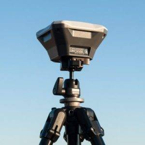
Mobile terrestrial scanning solution with RTK precision
Integrated Emlid and Pix4D solution to obtain digital models in minutes with topographical precision. Scan your assets with your mobile phone, save them online, annotate, measure and share them with your stakeholders. Verify geolocated positions and view the project in Augmented Reality.
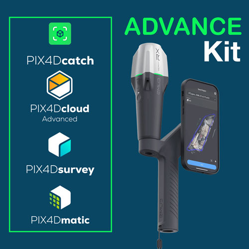
The Advance Kit comprises a complete hardware and software solution including:
- Data capture, desktop and cloud processing license:
- PIX4Dcatch Pro annual license.
- PIX4Dmatic annual license.
- PIX4Dsurvey annual license.
- PIX4Dcloud Advance annual license.
- PIX4Dcatch online training.
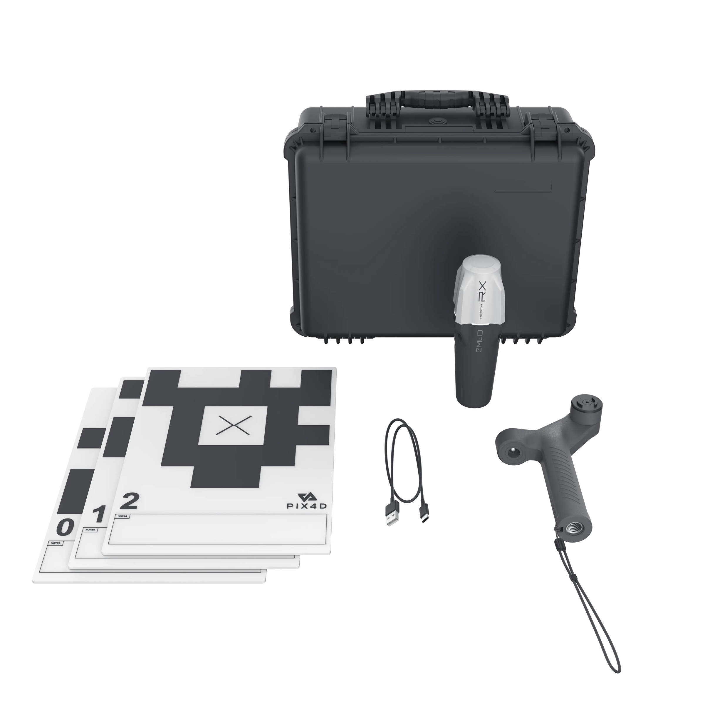
- GPS receiver with scanning accessories:
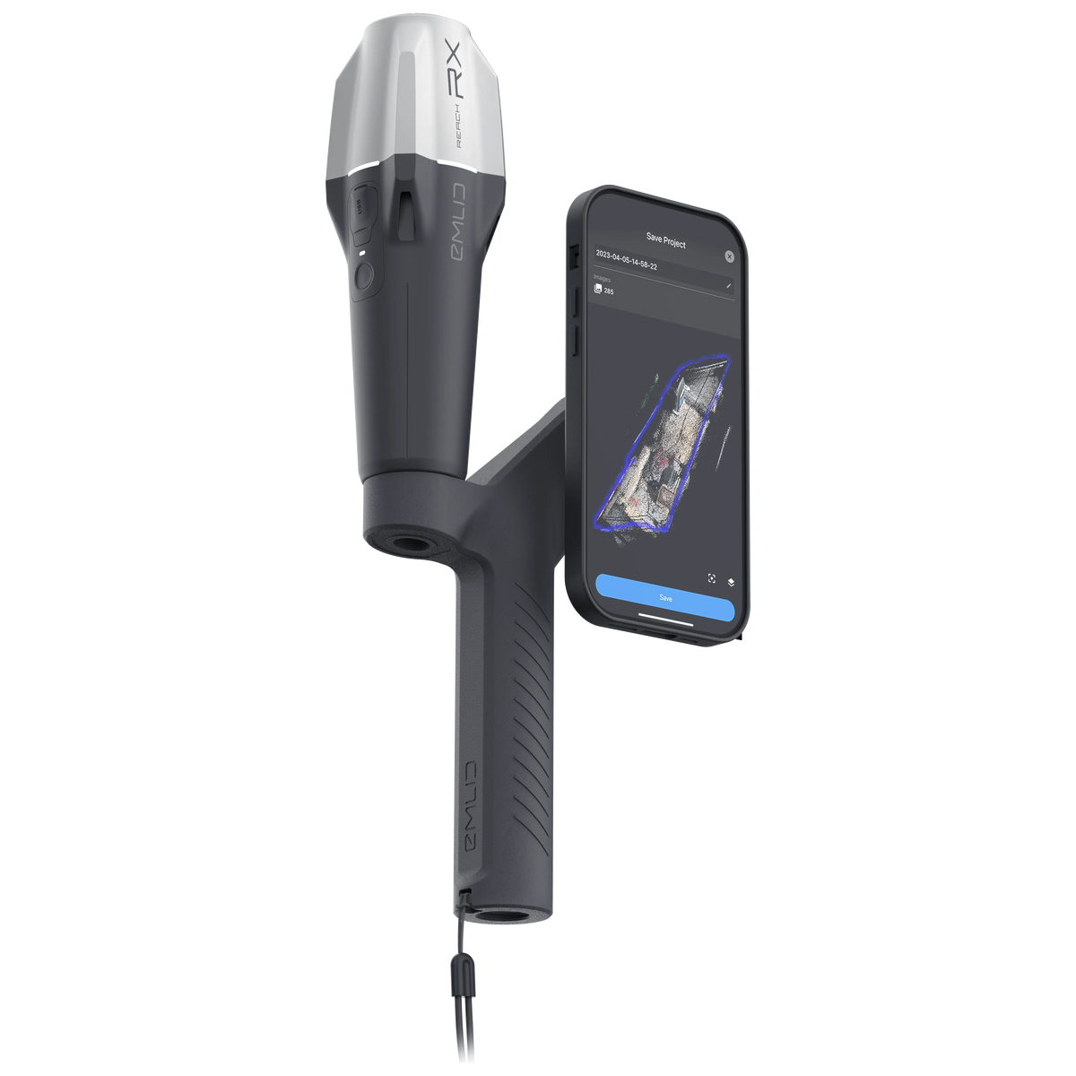
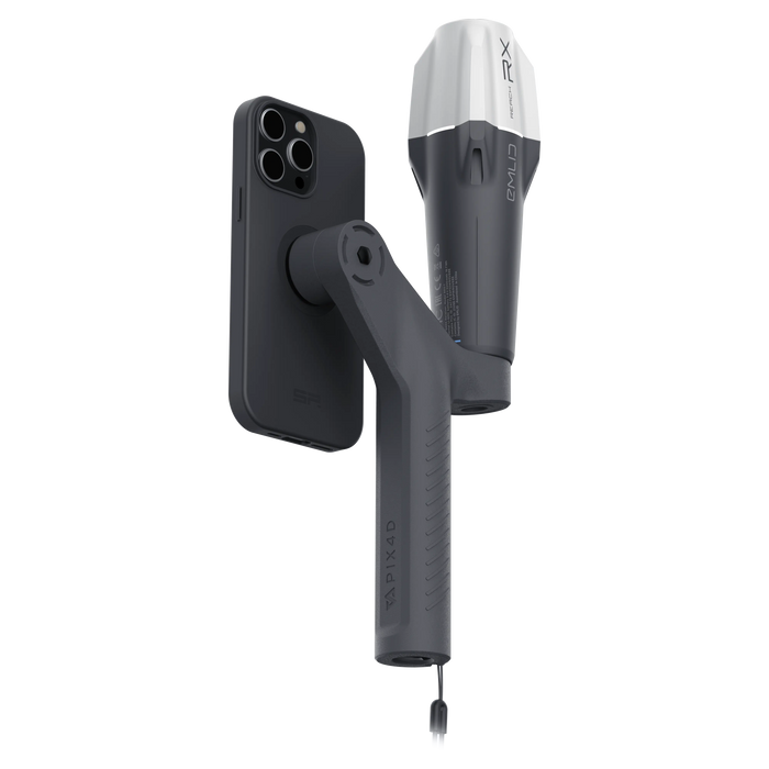
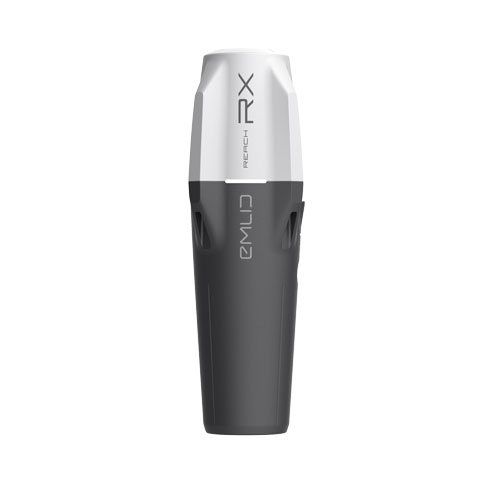
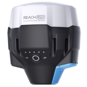
- GNSS Reach RX GPS receiver with USB type C cable.
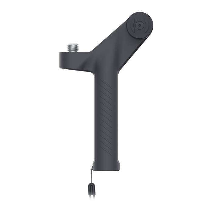
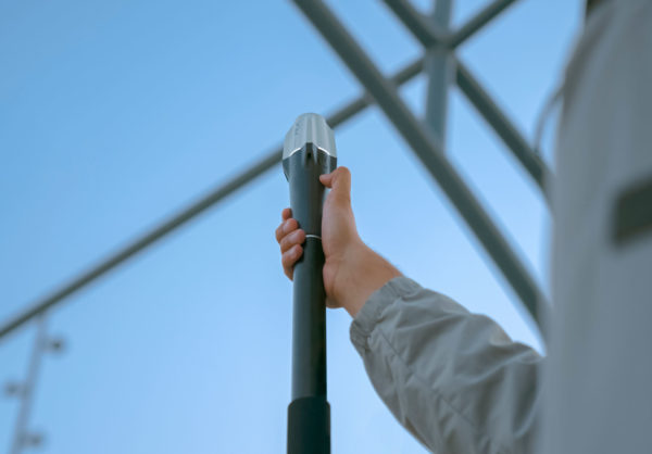
- Handheld support with strap for scanning.
- 5 labels for automatic georeferencing of points (Tags).
- 3 mm allen key.
- Carrying case.
You may also like…
Pix4D & Emlid Scanning kit ADVANCE
With the Emlid Reach RX & PIX4D GPS Kit you will get a powerful multifunctional tool that can be used as classic topography GPS equipment and also by adding an iPhone phone with LIDAR technology you will be able to obtain point clouds and digital twins in an agile, fast, simple and extremely precise.
The EMLID & PIX4D kit combines GPS RTK technology with close-up photogrammetry performed via a mobile phone to generate high-quality scans in record time.
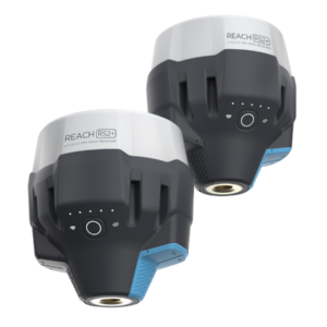
Reach RX: GPS GNSS Rover equipment with centimeter precision
Small and lightweight equipment for collecting data with centimetric precision. Works with network fixes (NTRIP).

It works with the Emlid Flow 360 app and is compatible with third-party apps like TCP-GPS.
Easy to get started, no configuration required
Reach RX uses Bluetooth Low Energy (BLE) which allows you to connect and start measuring with your smartphone or tablet in seconds. Enable Bluetooth on your iOS or Android device, find your Reach RX in Emlid Flow, add network fix credentials, and get your first point. There is no setting to go wrong.
It couldn’t be simpler!
Accurate results to the centimeter
Reach RX tracks GPS/QZSS, Galileo, Glonass and Beidou and gets a solution in less than 5 seconds, even in difficult conditions.
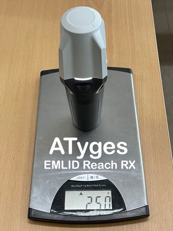
Pocket-sized and lightweight
The weight of Reach RX is only 250 grams. Take it anywhere: It weighs less than a soda can and fits in any glove compartment or backpack pocket.
PIX4Dcatch: Transform your reality into accurate 3D models with PIX4Dcatch
PIX4Dcatch can create detailed, georeferenced 3D models using both photogrammetry and LiDAR technology from your smartphone.
Georeferenced 3D scanningPIX4Dcatch can create detailed, georeferenced 3D models using both photogrammetry and LiDAR technology from your smartphone. | 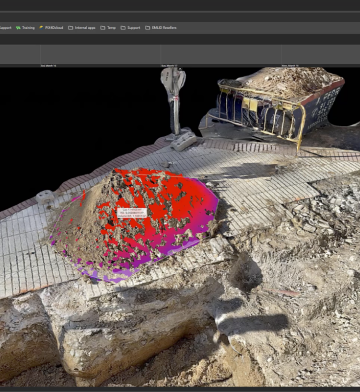 |
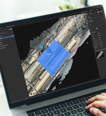 | Processing options versatileFlexible solutions for processing, including direct upload to PIX4Dcloud for easy processing and/or export to PIX4Dmatic for advanced control. |
RTK support with Emlid Reach RXAchieve absolute centimeter accuracy in your 3D models with PIX4Dcatch and EMLID Reach RX. | 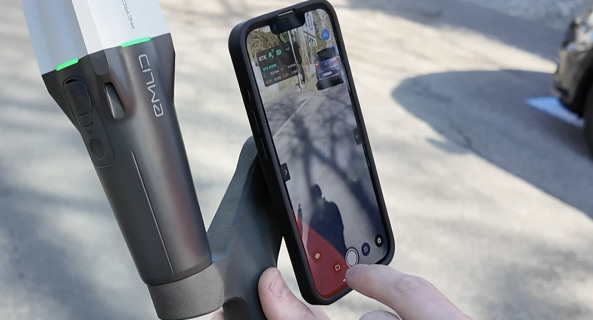 |
 | Innovative AR featuresUse AR to easily detect GCP and view CAD and as-built design overlays for construction analysis. |
Related products
-
Pix4Dreact
From: 390,00€ Select options This product has multiple variants. The options may be chosen on the product page -
Sale!
Pack PIX4Dmatic & PIX4dFields
From: 3.325,00€ Select options This product has multiple variants. The options may be chosen on the product page -
PIX4D Mapper Education
From: 1.500,00€ Select options This product has multiple variants. The options may be chosen on the product page