PROMOTIONS AND OFFERS Discounts on multiple DJI, EMLID and Pix4D products
We offer all kinds of technical solutions for companies and individuals. We advise you and inform you of everything.
Sale!
Secure payment
Shipping in 24/48h
Technical advice
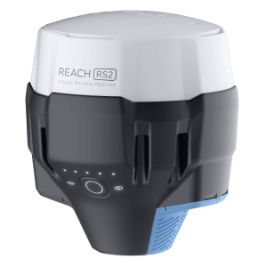
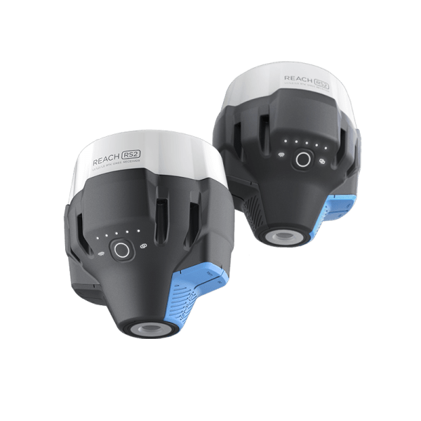
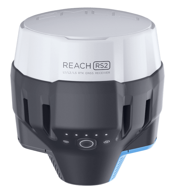
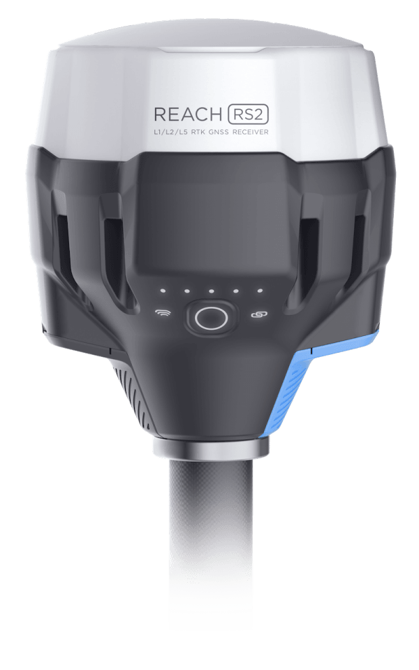
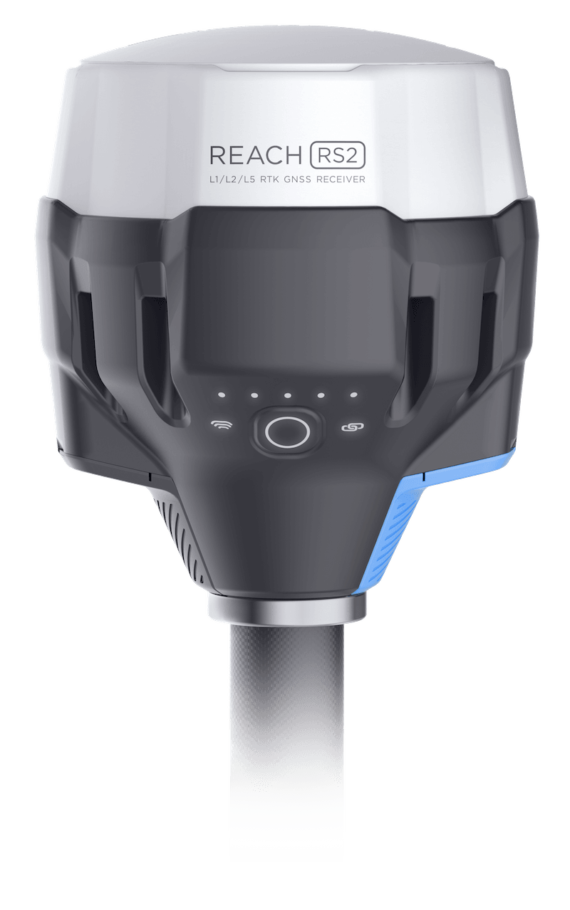
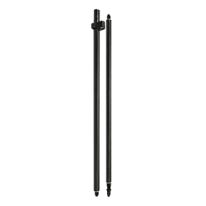
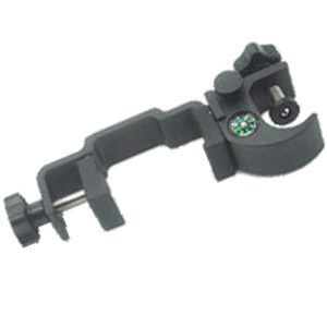
GPS Reach RS2 – Survey Kit (Base + Rover)
4.798,00€Original price was: 4.798,00€.3.900,00€Current price is: 3.900,00€. price without VAT (-18.7%)
Out of stock
Two multi-frequency RTK GNSS receivers with centimeter accuracy with control application included for surveying, point-taking and navigation in RTK and PPK mode. Suitable to work as Rover / Base.
Excellent software for processing drone images, excellent communication, nice people! Thank you so much. Highly recommend their software!
Publicado en
Razib Ahmed
Great team with experienced professionals. I experienced quick response from the technical support team eventhough I was not their customer. Thank you Fede A and your team.
Publicado en
Esteban Laffitte
Gran equipo de profesionales, siempre dispuestos a aclarar cualquier duda tanto en la pre como en la post-venta. Enhorabuena por el servicio qué ofreceis y la calidad de los productos que vendeis.
Publicado en
JOSÉ ANTONIO MARTÍNEZ SÁNCHEZ
He colaborado con ellos, son muy profesionales y muy recomendables.
Publicado en
Jose Maria Marin Poley
Hasta ahora todo correcto y rápido.
Publicado en
Maxi Diaz
La atención al cliente ha sido excelente. Envío a Canarias sin complicación. Recomendado.
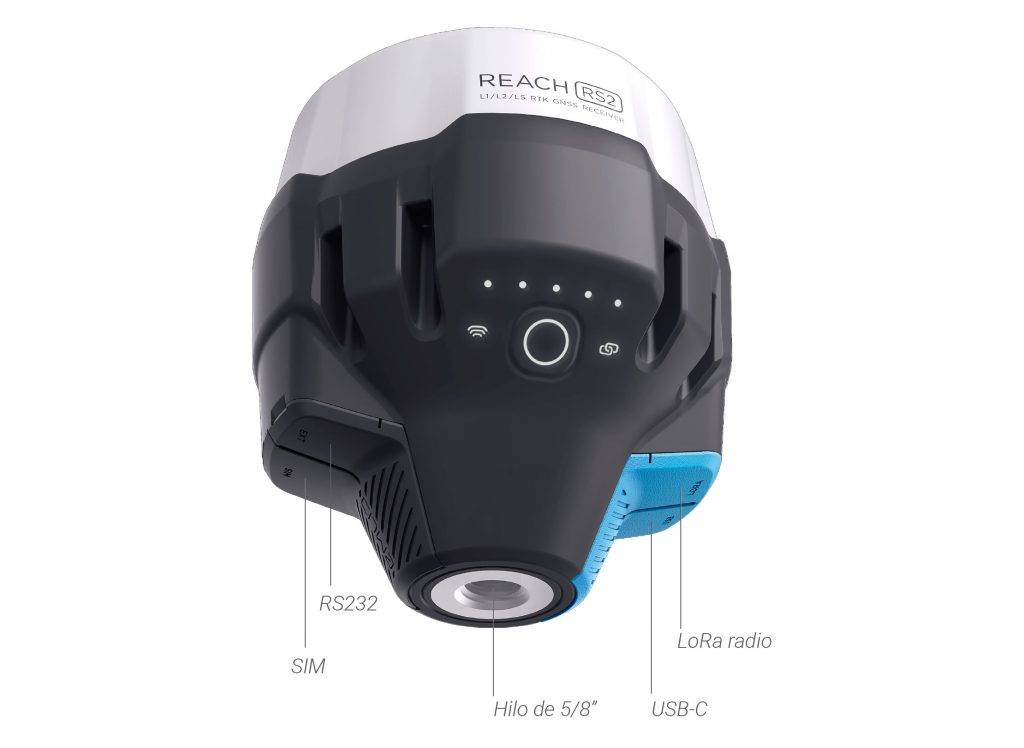
The Reach RS2 GPS Survey Kit consists of a pair of Reach RS2 multifrequency GNSS receivers for Rover/Base configuration.
Configurable interchangeably as Rover and Base teams
With the Reach RS2 GPS Survey Kit get Fixed Solution in seconds
Reach RS2 gets a fixed solution in just seconds and maintains solid performance even in difficult conditions. Centimeter accuracy can be achieved in distances of 60 km in RTK and 100 km in PPK mode, in addition thanks to the use of the Rover/Base configuration does not depend on third-party equipment.
PPP support
RINEX RAW data supports OPUS, CSRS-PPP, AUSPOS, and other PPP services, so you can now get results with centimeter accuracy anywhere on Earth. Process RINEX files in an online service and get a position with absolute precision.
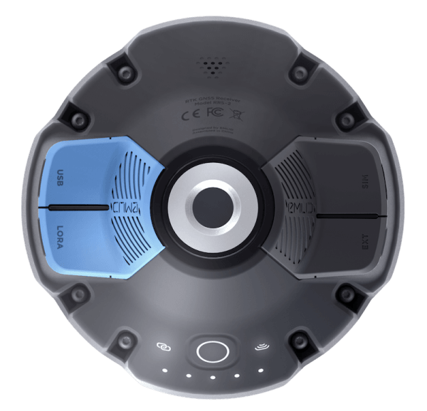
Built-in 3.5G modem
Reach RS2 features a low-power HSPA 3.5G modem with 2G support and global coverage. Corrections can now be accessed or issued through NTRIP independently, without relying on the intertet connection of an external device.
22 hours on 1 single charge
Up to 22 hours of self-driving work when recording data and up to 16 hours as a 3G mobile. Even in cold climates, you no longer need to carry replacement batteries. Reach RS2 can be charged from a conventional USB charger or via a PowerBank via USB-C.
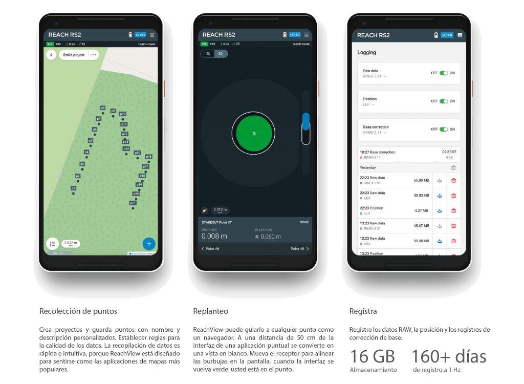
Survey with Reach View
The easiest software to use for data collection, which is available for both Android and iOS as well as Linux.
With ReachView you can take and rethink points and control all the features of Reach RS2. You can configure the base station, log RINEX data, and configure NMEA output: everything can be done with ReachView.
Export data in multiple formats
DXF, CSV, GeoJSON and ESRI Shapefile
Import data into multiple formats
DXF, CSV and GeoJSON
Register and store RINEX
RINEX 2.X and RINEX 3.X
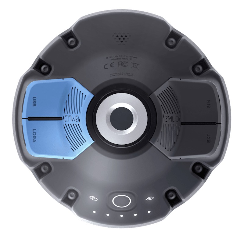
Base Station Mode
Use Reach RS2 to configure your own base station and transfer corrections over the network, via NTRIP/TCP or LoRA radio or record base readings for the post-process processor. Reach RS2 works with multiple market rovers and is compatible with Reach RS+, Reach M+ and Reach M2.
It is compatible with other market receivers that support RTCM 3 and NTRIP, plus external radios are compatible via RS-232.
Compatible with third-party professional survey ingapographic applications
With the free native Reach View app you can fully control your GPS Reach, but if you want you can use traditional surveying software and not modify your workflow.
GNSS Reach RS2 receivers are compatible with third-party professional surveying applications such as TCP-GPS,TopView, Carlson SurvCE/SurvPC, QGIS, Magnet Fields, etc. If you already have those software with your topographic GPS, take advantage of your investment and your current workflow.
Real-time navigation
Reach RS2 can send precise coordinates via Bluetooth or Wi-Fi, plus the RS-232 interface allows you to connect Reach RS2 directly to an autosteer system.
Supported apps
MachineryGuide, AgriBus-Navi, Efarer, Agripilot.
TCP-GPS, Top-View, QGIS, Magnet Fields.
Solution format
NMEA, ERB, plain text
Online support
Ask us any questions about this device via our email and visit the official EMLID forum and product support community.
Due to current government measures, we are teleworking. Therefore, we would ask you to please write us an e-mail at store@atyges.es to tell us about your doubts. We will reply to you immediately.
Para ofrecer las mejores experiencias, utilizamos tecnologías como las cookies para almacenar y/o acceder a la información del dispositivo. El consentimiento de estas tecnologías nos permitirá procesar datos como el comportamiento de navegación o las identificaciones únicas en este sitio. No consentir o retirar el consentimiento, puede afectar negativamente a ciertas características y funciones.
Funcional
Always active
El almacenamiento o acceso técnico es estrictamente necesario para el propósito legítimo de permitir el uso de un servicio específico explícitamente solicitado por el abonado o usuario, o con el único propósito de llevar a cabo la transmisión de una comunicación a través de una red de comunicaciones electrónicas.
Preferencias
El almacenamiento o acceso técnico es necesario para la finalidad legítima de almacenar preferencias no solicitadas por el abonado o usuario.
Estadísticas
El almacenamiento o acceso técnico que es utilizado exclusivamente con fines estadísticos.El almacenamiento o acceso técnico que se utiliza exclusivamente con fines estadísticos anónimos. Sin un requerimiento, el cumplimiento voluntario por parte de tu Proveedor de servicios de Internet, o los registros adicionales de un tercero, la información almacenada o recuperada sólo para este propósito no se puede utilizar para identificarte.
Marketing
El almacenamiento o acceso técnico es necesario para crear perfiles de usuario para enviar publicidad, o para rastrear al usuario en una web o en varias web con fines de marketing similares.


 Secure payment
 Shipping in 24/48h
 Technical advice


 Survey with Reach View