


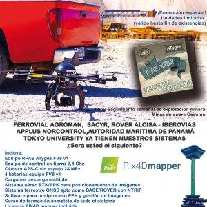
PROMOTIONS AND OFFERS
Discounts on multiple DJI, EMLID and Pix4D products
Sale!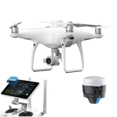
 Secure payment
 Shipping in 24/48h
 Technical advice

 Secure payment Shipping in 24/48h Technical advice
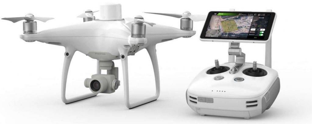
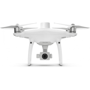
DJI Phantom 4 RTK + GPS GNSS Multifrequency Topographic + ATygeo PPK
Original price was: 6.600,00€.6.250,00€Current price is: 6.250,00€. price without VAT (-5.3%)
PACK TOPOGRAFIA LITE DJI PHANTOM 4 RTK AND GPS TOPOGRAF (Phantom 4 RTK+ GPS multifrequency topographic GPS L1/L2/L5 + Post-processing software ATygeo PPK)
LIMITED EDITION PROMOTIONAL PACKAGE WITH PHANTOM 4 RTK TO MAKE SURVEYWITH DRONES
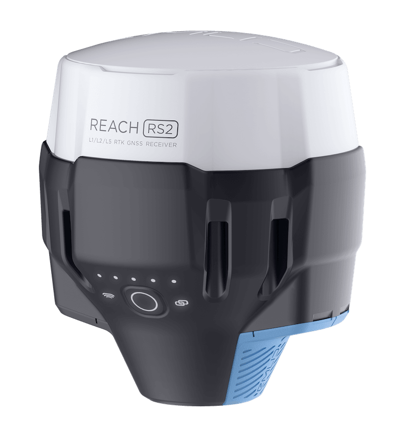
This promotional pack consists of a commercial consumer RPAS model Phantom 4 RTK, a topographic GNSS GPS receiver topographical sub-centimeter reach R2 (which allows to take checkpoints and act as base receiver) and a software license ATygeo PPK that allows perform kinematic post-processing with the data captured by the drone and with the data from an external base (topographic GPS included in the package or data from an external reference station).
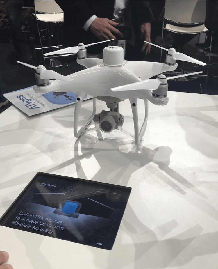
The Phantom 4 RTK provides its users with information with a centimeter level of accuracy with fewer ground control points than previously needed.
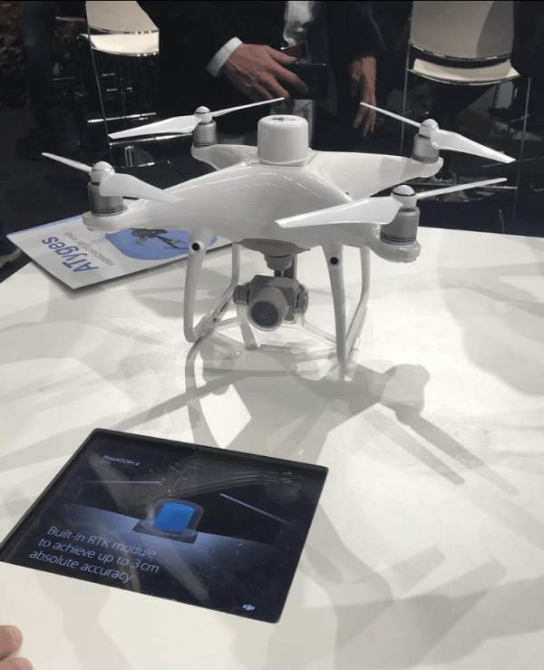
Positioning with centimeter accuracy
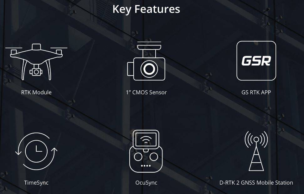
The Phantom 4 RTK includes a fully integrated RTK module that provides real-time centimetric position information for absolute accuracy in image meta-information. Right next to the RTK receiver is a redundant GNSS module, allowing you to maintain flight stability in places with poor signal reception, such as densely populated cities. The combination of these two modules allows the Phantom 4 RTK to optimize flight safety while ensuring that as accurate information as possible is achieved for complex prospecting, mapping and inspection tasks.
The Phantom 4 RTK adapts to any workflow. You can connect your positioning system to the D-RTK 2 mobile station, to NTRIP (Network Transport of RTCM via Internet Protocol) via a 4G accessory or a local Wi-Fi network, or store satellite information for use in PPK (Cinematic Postprocessing).
Get accurate data with TimeSync
The new TimeSync system has been created to continuously synchronize the flight controller, camera and RTK module, to take full advantage of the Phantom 4 RTK positioning modules. In addition, TimeSync ensures that all photos will use the most accurate meta-information and secures positioning data to the center of the CMOS – optimizing the results of photogrammetric methods and allowing the image to achieve a level of accuracy centimeter.
Dedicated flight planning app
A new GS RTK app gives users more possibilities to control their Phantom 4 RTK, with two planning modes (photogrammetric and trajectory) that join the traditional flight mode. Planning modes allow the pilot to set the drone’s flight path and set parameters such as overlap ratio, altitude, speed and camera settings, among others. This allows you to automate mapping or inspection workflows.
The GS RTK application has been created with its users in mind, and has numerous functions designed for specific mapping or inspection workflows. The app allows you to directly upload KML area files to plan flights in the office, has a shutter priority mode with which exposure stays constant on all photos, and a strong wind alarm prevents pilots from adverse weather conditions.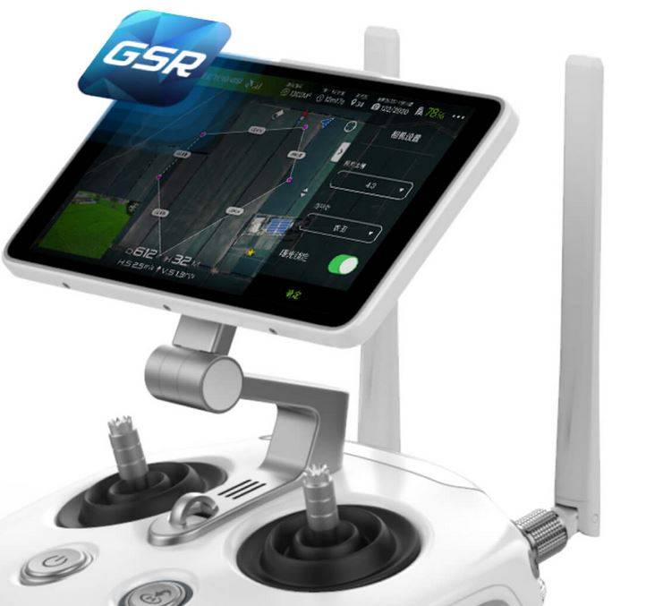
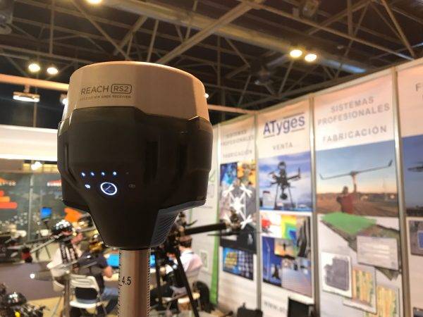
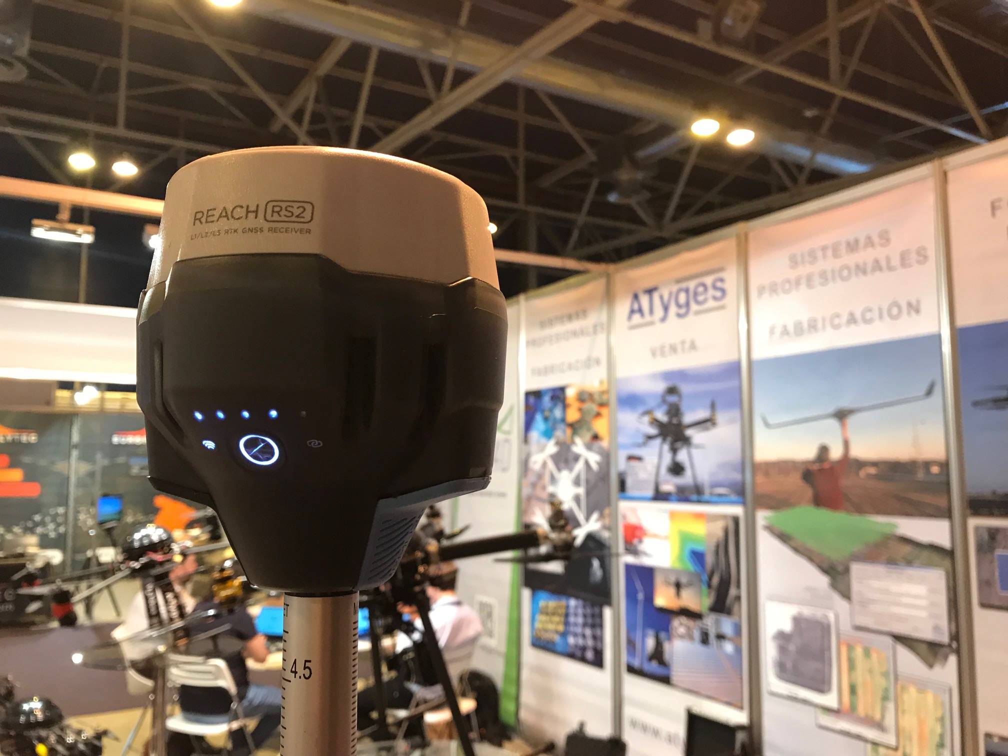
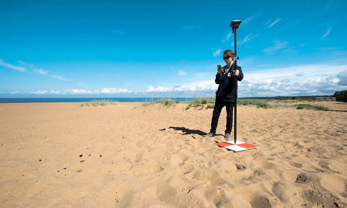
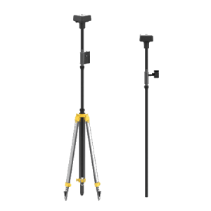
With versatile GNSS L1/L2/L5 GPS topographic receiver to act as a rover and as a base
Complement the missions of your Phantom 4 RTK with a topographic GNSS GPS with subcentimetric accuracy that serves both to take some checkpoint, and to make observations in base mode to perform PPK post-processing ensuring network coverage and not to depending on external connections during the flight of your drone, while improving the accuracy of your equipment.
Includes software for post-processing images using PPK technology
You will be able to perform cinematic post-processing of images captured with your Phantom 4 RTK without the need for a permanent ground-based connection and without connecting to the reference station via phone. Forget about signal quality loss and images without differential correction thanks to the tool that we include in the kit.
You may also like…
Complete system for surveying with drones with an RTK and PPK system.
Related products
-
Sale!
D-RTK GNSS precision mobile station
Original price was: 2.975,20€.2.650,00€Current price is: 2.650,00€. price without VAT (-10.9%) Read more -
Sale!
DJI Phantom 4 RTK
Original price was: 4.710,00€.1.850,00€Current price is: 1.850,00€. price without VAT (-60.7%) Read more -

DJI Enterprise Shield Insurance (Phantom 4 RTK)
574,35€ price without VAT Add to cart