


PROMOTIONS AND OFFERS
Discounts on multiple DJI, EMLID and Pix4D products
Sale!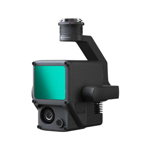
 Secure payment
 Shipping in 24/48h
 Technical advice
Secure payment Shipping in 24/48h Technical adviceZenmuse L1
Original price was: 10.350,00€.7.525,00€Current price is: 7.525,00€. price without VAT (-27.3%)
Out of stock
Matrice 300 RTK equipment and its cameras are not available for automatic sale over the internet by DJI brand criteria.
Request a quote using this form and we will send you a personalized offer
We improve your budget: Do not hesitate to contact us!
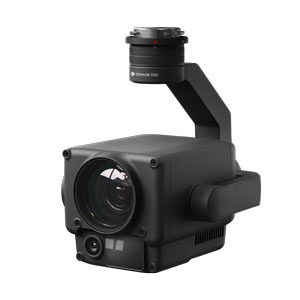
LIDAR for DJI Zenmuse L1 drone
Solution that integrates LIDAR and RGB camera for DJI drone in a single device for the team Matrice 300 RTK .
You may also like…
Zenmuse L1
A Lidar + RGB solution for aerial surveying
The Zenmuse L1 integrates a Lidar module from the house Livox, a high precision IMU and a camera with a 1-inch CMOS sensor in a stabilized 3-axis gimbal.
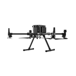
When used with the Matrice 300 RTK and DJI Terra, the Zenmuse L1 sensor forms a complete solution that provides real-time 3D data around the clock, efficiently capturing the details of complex structures and delivering highly accurate reconstructed models.
 Comprehensive solution: Integrates a Lidar module, an RGB camera and a high precision IMU
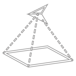 Productivity: Covers up to 2 square km in a single flight
 High precision: Vertical precision: 5 cm / Horizontal: 10 cm
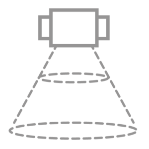 Capture: 240,000 points per second
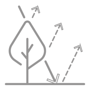 Return: Supports 3 return echoes
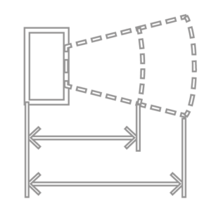 Detection range: 450 m (80% reflectivity, 0 klx)
 Certification: Protection level IP44
 LiewView: Real-time 3D point cloud
Digitize accurately and efficiently
Exceptional efficiency
Generate real-time, true-color point cloud models or acquire 2 km2 of point cloud data in a single flight using Livox’s in-house Lidar module with a 70 ° field of view and a visible light camera with a 1 inch sensor.

Unmatched precision
Perform centimeter-accurate reconstructions thanks to the high-precision IMU, a vision sensor for positioning accuracy, and GNSS data incorporation.

Ready when you are
The IP44 rating allows the L1 to operate in rainy or foggy environments. The active scanning method of the Lidar module allows you to fly at night.

Visualize data as you fly
Livox Lidar Module
- Lidar framing with up to 100% effective results in the point cloud
- Detection range: 450 m (80% reflectivity, 0 klx) / 190 m (10% reflectivity, 100 klx)
- Effective point rate: 240,000 pts / s
- Supports 3 return echoes [3]
- Line scan mode and non-repeating scan mode
Everything in view with RGB camera

- 20MP
- 1 inch CMOS
- Mechanical shutter
Precise details at your disposal with highly accurate IMU

- Accuracy: 0.025 ° (roll / pitch) / 0.08 ° (yaw)
- Vision sensor for positioning accuracy
- GNSS, IMU, RGB data fusion
<
<
Doubts? Do you already have a budget and want us to improve it?
Related products
-
Zenmuse H20
3.755,00€ price without VAT Read more -
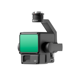
Zenmuse L2
Desde: 10.818,15€ Select options This product has multiple variants. The options may be chosen on the product page -
ATygeo Thermal
590,00€ price without VAT Add to cart