PROMOTIONS AND OFFERS
Discounts on multiple DJI, EMLID and Pix4D products

We offer all kinds of technical solutions for companies and individuals. We advise you and inform you of everything.

Sale!
Secure payment Secure payment
Shipping in 24/48 h. Shipping in 24/48h
Technical advice Technical advice

PIX4D Fields- Precision Agriculture

From: 260,00

Market-leading processing and interpretation software for precision agriculture and crop mapping

Aerial crop analysis

Pix4Dfields v1.6 converts multispectral images into accurate maps of agronomic indexes, using RGB and multispectral images to generate orthomosaics and high-resolution maps. Easily integrate drone-based technology into your precision farming operations, processing locally or in the cloud whenever and wherever you want.


Jess Gregory
Jess Gregory
2022-08-22
Excellent software for processing drone images, excellent communication, nice people! Thank you so much. Highly recommend their software!
Razib Ahmed
Razib Ahmed
2022-08-22
Great team with experienced professionals. I experienced quick response from the technical support team eventhough I was not their customer. Thank you Fede A and your team.
Esteban Laffitte
Esteban Laffitte
2021-12-19
Gran equipo de profesionales, siempre dispuestos a aclarar cualquier duda tanto en la pre como en la post-venta. Enhorabuena por el servicio qué ofreceis y la calidad de los productos que vendeis.
JOSÉ ANTONIO MARTÍNEZ SÁNCHEZ
2021-12-17
He colaborado con ellos, son muy profesionales y muy recomendables.
Jose Maria Marin Poley
2021-09-23
Hasta ahora todo correcto y rápido.
Maxi Diaz
Maxi Diaz
2021-09-15
La atención al cliente ha sido excelente. Envío a Canarias sin complicación. Recomendado.

Aerial crop analysis

Pix4DFields converts multispectral images into accurate reflectance maps and indexes, such as NDVI, using RGB images to generate high-resolution orthomosaics. Easily integrate drone-based technology into your precision agriculture operations, processing locally whenever and wherever you want.

Simple workflow

Generate index maps, such as NDVI, and turn them into application maps for agricultural machinery. Camera flexibility Multispectral and RGB cameras. Radiometric Accuracy Optimal results of multispectral cameras designed by Ag.

Precision

Convert High Resolution images into consistent images and comparable crop maps into time series with Pix4Dfields.
INSTANT RESULTS

With the new instant processing generates high-resolution maps in the same field. Fast processing with lower resources.
INTUITIVE AGRICULTURE

Layer comparison, harvest zoning and fertilizer dose prescription tools help you interpret and work with your maps better.

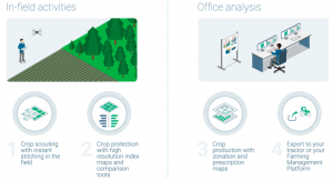
DECISION-MAKING BEGINS IN THE FIELD ITSELF

Addressing the most common fields of application, such as digital exploration and crop protection, production and collection, insurance and planting with Pix4Dfields.
 

Can we help you?

Do not hesitate to contact us!

If you want a trial license or want to contact us

Valóranos

Additional information

Licencia

Licenses available for temporary use with support and updates included during the term.


×
IMPORTANT

Due to current government measures, we are teleworking.
Therefore, we would ask you to please write us an e-mail at store@atyges.es to tell us about your doubts.
We will reply to you immediately.

×