Secure payment
 Shipping in 24/48h
 Technical advice


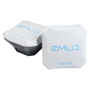
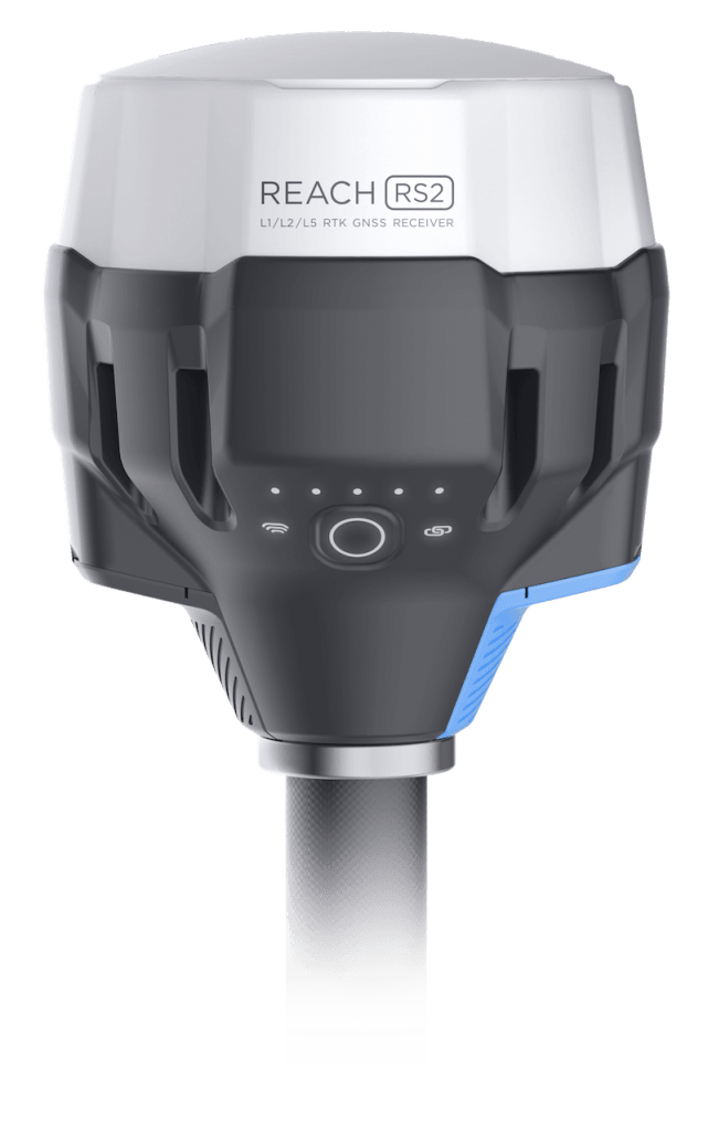
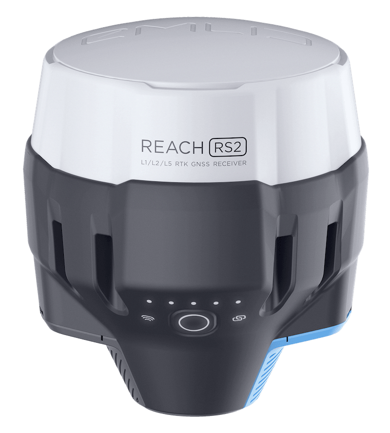
GPS GNSS RTK Reach RS2
GPS RTK Reach RS2 is a Multi-band RTK GNSS receiver with centimeter precisión used for surveying, mapping and navigation.
Gets a fix in seconds
Reach RS2 gets a fixed solution in just seconds and maintains robust performance even in challenging conditions. Centimeter accuracy can be achieved on distances up to 60 km in RTK, and 100 km in PPK mode.
PPP support
RINEX raw data logs are compatible with PPP services so you can now get centimeter-precise results in any place on Earth. Process RINEX files in an online service and get position with absolute accuracy.
Built-in 3.5G Modem
Reach RS2 features a power-efficient 3.5G HSPA modem with 2G fallback and global coverage. Now corrections can be accessed or broadcasted over NTRIP independently, without relying on an Internet connection on your phone.
22 hours on 1 charge
Up to 22 hours of autonomous work when logging data and up to 16 hours as a 3G rover, even in cold weather—no more need to carry spare batteries with you. Reach RS2 can charge from a USB wall charger or a power bank over USB-C.
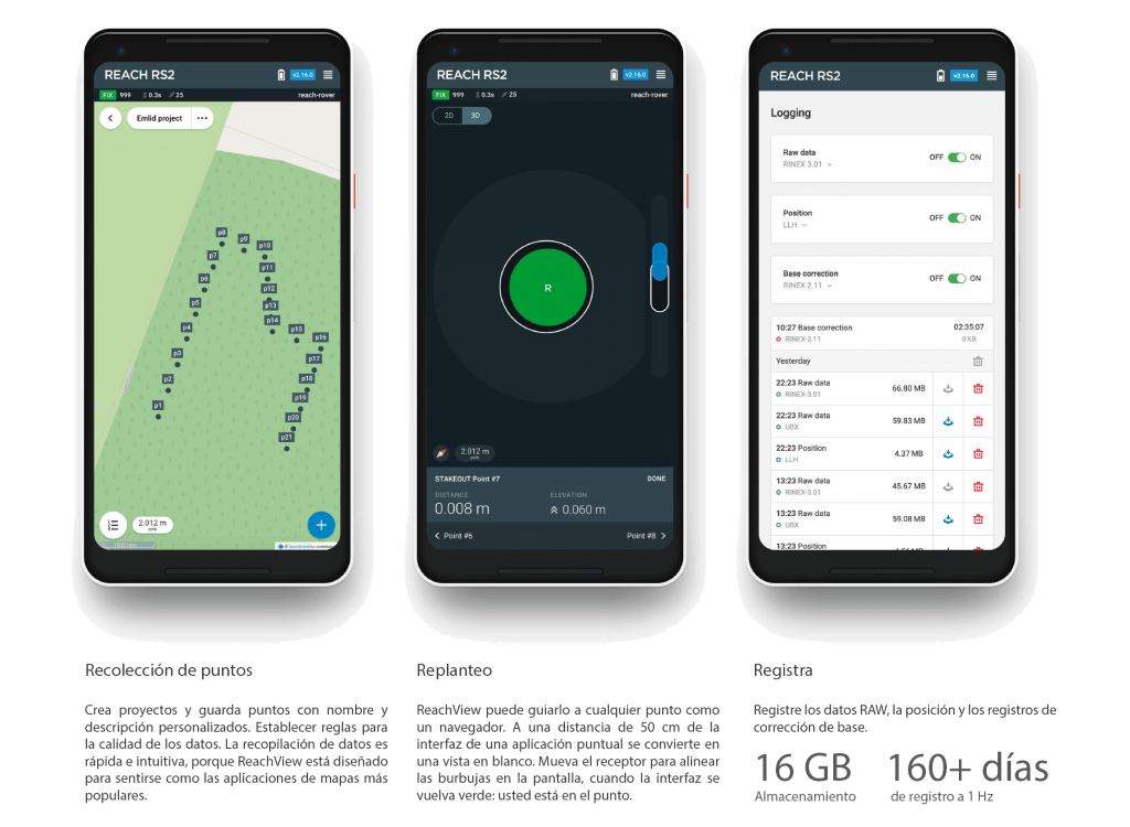
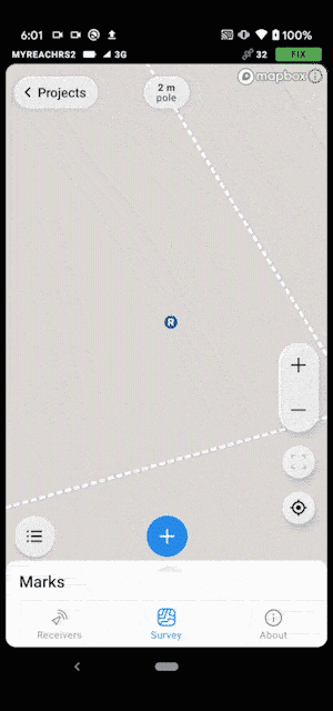
Surveying with ReachView
The most user-friendly software for data collection that is available both for Android and iOS. With ReachView, you can collect and stake out points and control all the features of Reach receivers, such as setting up a base station, logging RINEX data, and configuring NMEA output.
Point collection:
create projects, save points, and export in industry standard formats
Record each position as a point with centimeter precise coordinates. Export projects and open them in GIS or CAD software like AutoCAD, ArcGIS, QGIS, and others.
Formats
DXF, CSV, GeoJSON y ESRI Shapefile
Stakeout:
Find points’ position on the ground
Stakeout is used to find exact physical locations of points. They can be collected in ReachView or imported from other CAD or GIS software.
Process of stakeout in ReachView has two steps: map view and bulls-eye. Map’s purpose is to help you navigate to points on long distances. When you get closer than 40 cm to the point, bulls-eye turns on to make it easier for you to visually match receiver and point.
Formats
DXF, CSV y GeoJSON
Logging in RINEX:
record raw data, position, and base correction logs
Record raw data, position and base correction logs. Point collection and recording of RAW data are independent processes and can be used simultaneously. ReachView has a simple and intuitive interface for logging configuration and control.
We provide our version of RTKLib for PPK. It’s free and can be downloaded from our docs.
Formats
RINEX 2.X y RINEX 3.X
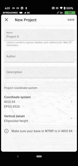
ReachView 3: Free app for Capture and Shake-out points
Now with ReachView 3 is more easy work.
The coordinate system support is finally here with more than a thousand coordinate systems available. No more need for third-party software for transformation! Create a survey project with ReachView 3 on your iOS/Android device, and you are ready for the RTK survey.
The selection is based on the EPSG and IGN registries and supports thousands of different coordinate systems worldwide.
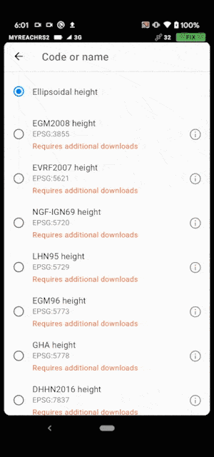
ReachView 3 has built-in support for grid and geoid transformations. Choose the appropriate coordinate system, and the app will prompt you to download all the required additional files. Currently, the app supports EGM2008 and many more local vertical datums around the globe.
You can rely on ReachView 3 when managing a project with thousands of points on the go. The new interface of ReachView 3 enables smooth navigation within the app, no matter how complex your project is.

The point collection and stakeout tools are now even more convenient to use than it was previously. For point collection, we have added time averaging, auto-naming, and description fields.
Keep all accounts for NTRIP services in one place and switch between them effortlessly, no matter how many of them you have. All credentials are stored inside the ReachView 3. You can set up the same correction input settings for several Reach units after only entering the credentials once.
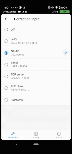
NTRIP or another Reach as a base station
Reach RS2 needs a base station as a source of corrections. That’s a requirement for centimeter accuracy in RTK and PPK. Base might be either another Reach RS2 receiver or an NTRIP service. VRS is also supported.
Reach RS2 works seamlessly with other Reach receivers over any link.
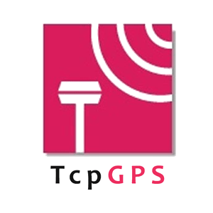
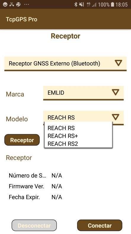
REACH RS2 IS COMPATIBLE WITH CLASICAL SURVEY APPS FROM 3rd PARTS
GNSS Reach RS2 sis compatible with third-party survey aplications like TCP-GPS, TopView, Carlson SurvCE/SurvPC, QGIS, Magnet Fields, etc.
If you already have these software with your topographic GPS, take advantage of your investment or ask us for a quote if you wish to purchase topographic software as an option.
Check official EMLID forum : Foro EMLID (Castellano)
Comes with LoRa antenna,
USB cable, and carrying case with a strap:
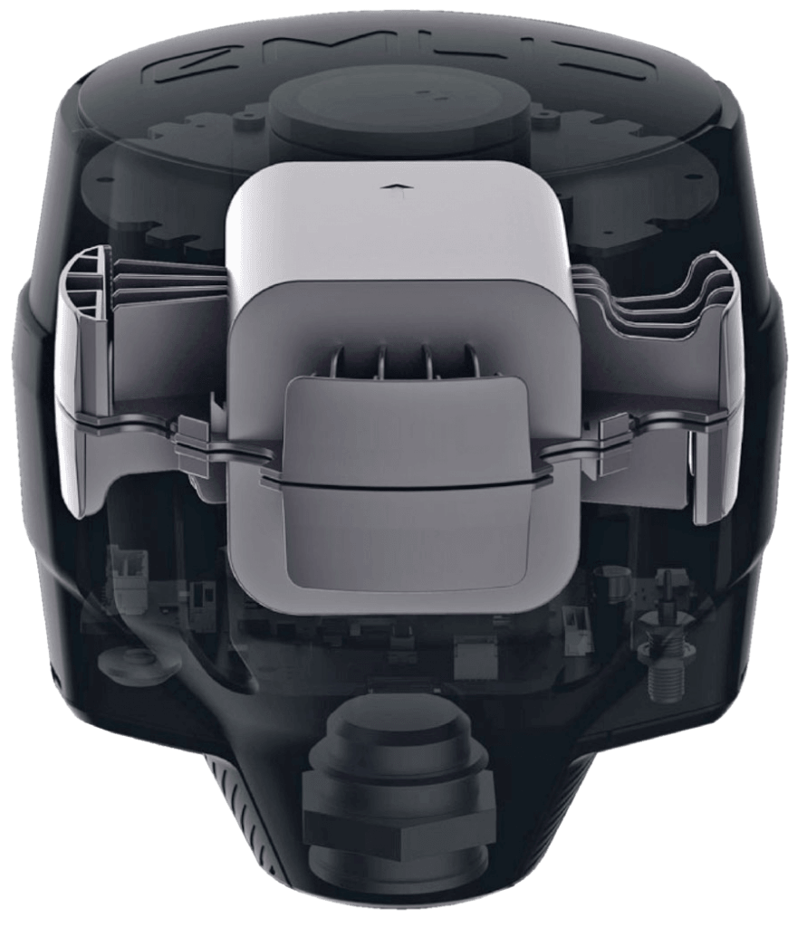
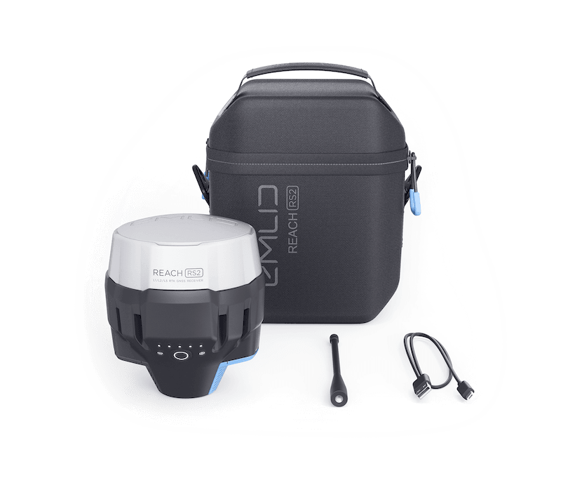 GPS RTK Reach RS2: Engineered to be tough
Reach RS2 is designed to work even in the most challenging environments.
IP67
RS2 is waterproof up to 1 m depth. All connectors are completely sealed and protected from water and dust with silicone plugs.
-20 ºC … 65ºC
We extensively tested Reach RS2 in conditions that simulate coldest winters and hottest summers.
Polycarbonate body
Polycarbonate, an extremely durable material that is used in bulletproof glass, makes Reach RS2 impact-resistant.
Covered with elastomer
This is a rubber-like material that forms a shock absorber around the whole device. In a sophisticated manufacturing process, elastomer is permanently bonded to the polycarboante base so that if your bipod falls over, Reach RS2 will bump off, no marks left.
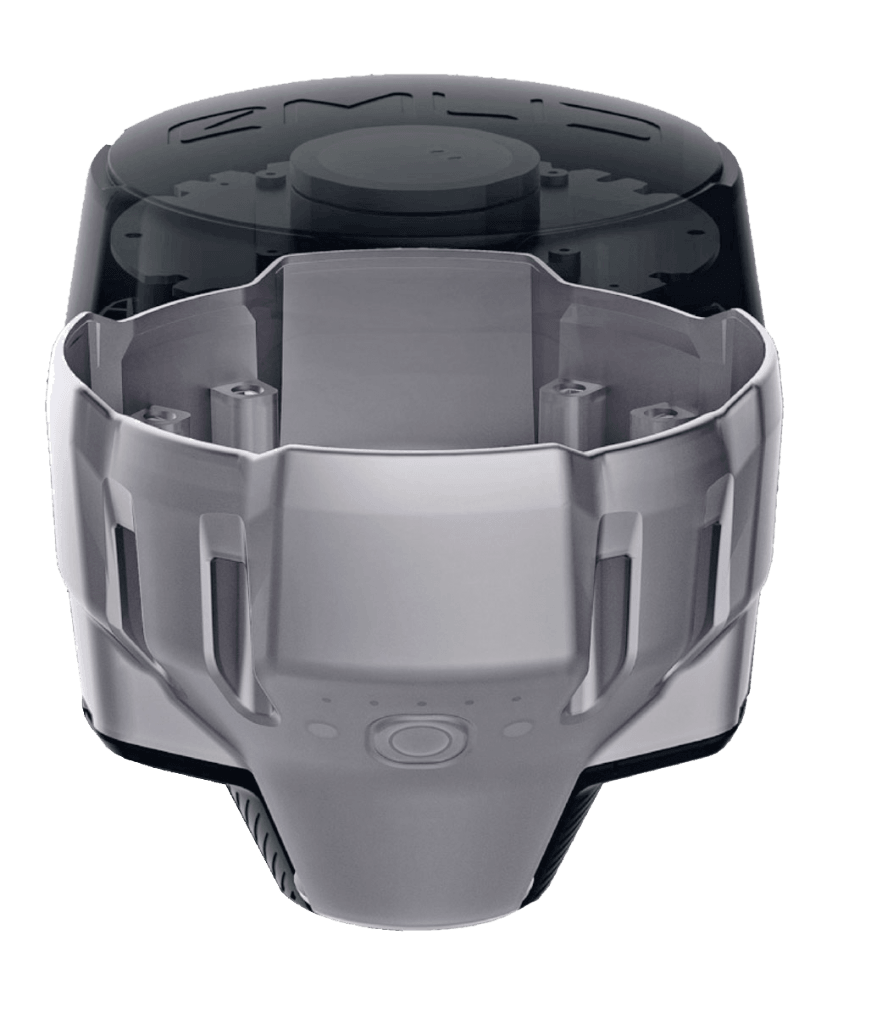
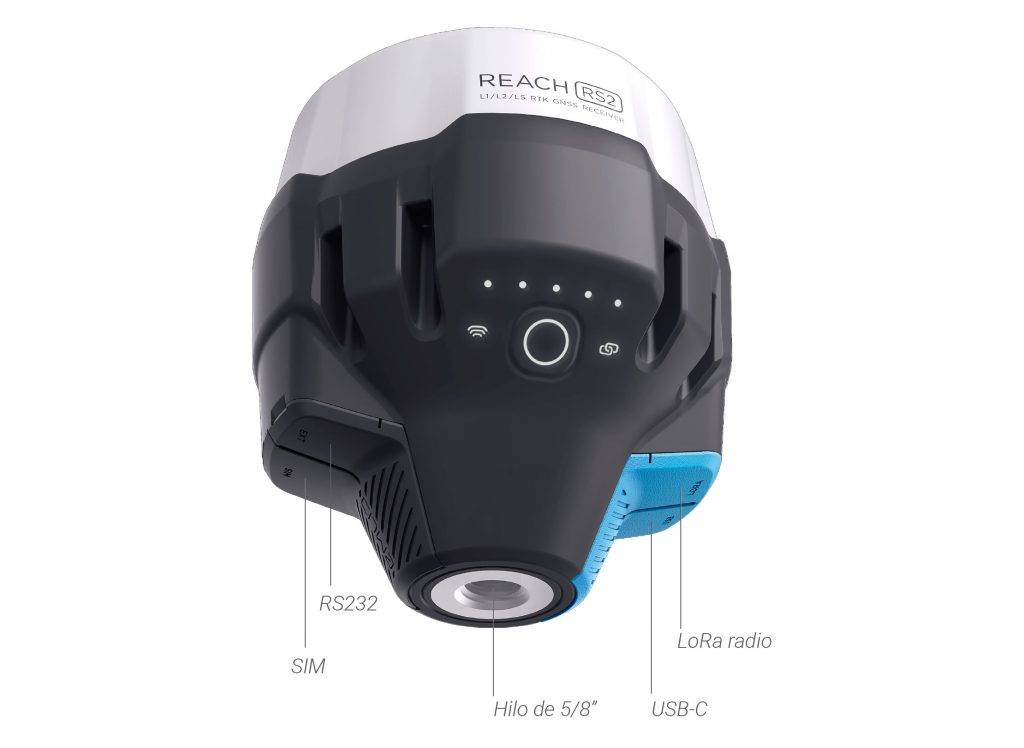
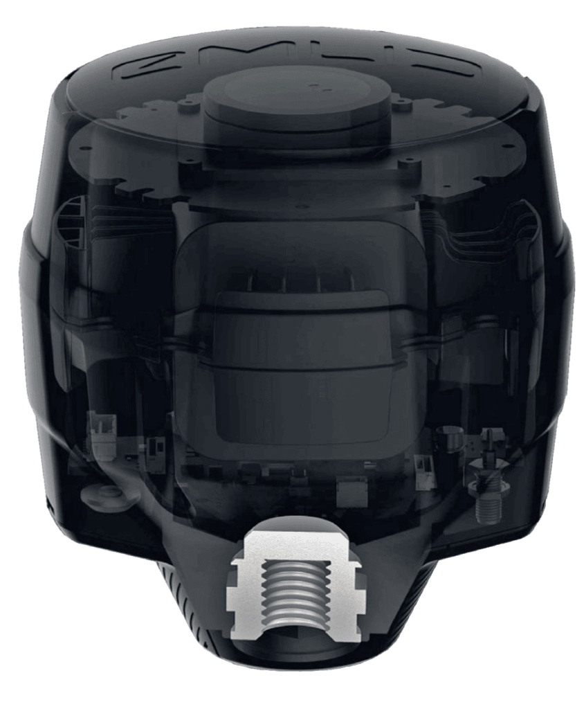
Rugged 5/8″ mount
A precision CNC machined threaded mount is inserted during the molding process and becomes one with the plastic.
The metal mount works as a heatsink, transferring heat away from the electronic components and ensuring stable operation in a hot climate.
LoRa radio
868/915 MHz: Frequency range
Up to 8 km
At only 100mW
300% more range
Compared with FSK radios at the same power
LoRa Spread Spectrum modulation can work on distances up to 4 times longer compared with traditional FSK radios at the same power output. This gives Reach RS2 robust radio performance without sacrificing battery life. LoRa radio is used to connect rover to base when Internet-delivered corrections are not available.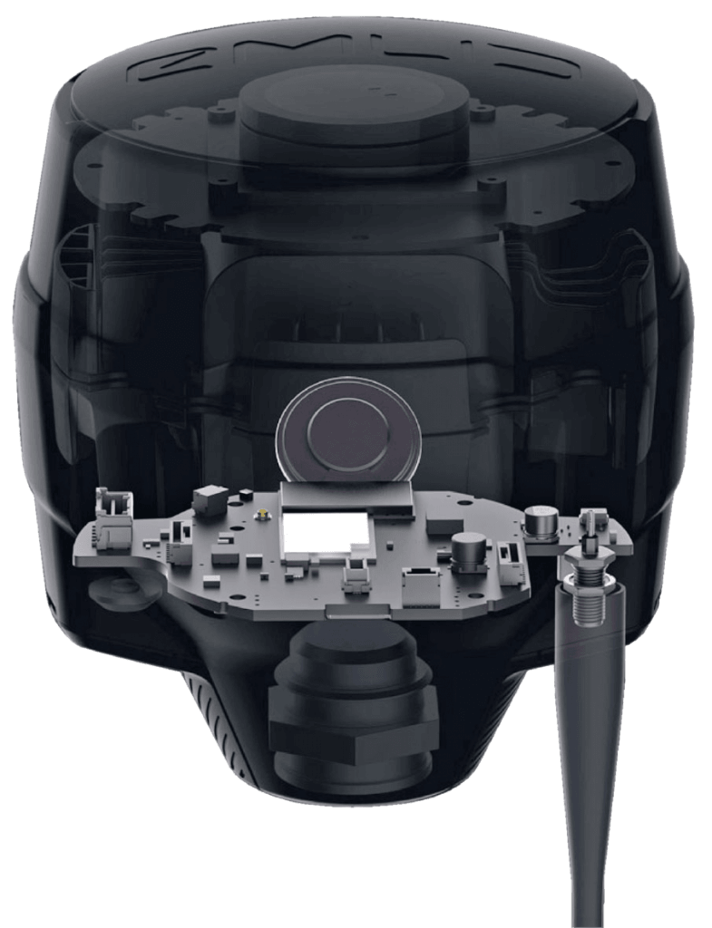
Industrial battery
LiFePO4
Industrial battery that handles both high and low temperatures well.
USB-C
Reach RS2 charges from any USB port and power bank.
2 000+ cycles
of charging and discharging while maintaining original capacity.
Reach RS2 works for up to 22 hours in static logging and up to 16 hours in RTK with cellular on. You don’t need to worry about having spare batteries or replacing them in the field. Hot-swaps are a thing of the past.
Compact and lightweight
128 x 142 mm
Fits in a small bag
950 g
Weighs less than a typical survey pole